






H520 RTF Hexacopter, ST16S, 2 Akkus, EU



| Numer artykułu | WF-891936 |
| Marka | Yuneec |
Nie ma jeszcze żadnych recenzji — Twoja może być pierwsza
Podziel się opinią o tym zakupie i pomóż innym klientom dokonać właściwego wyboruNie ma jeszcze pytań
Zadaj pytanie, aby dowiedzieć się więcej o produkcie 0.0
0.0
The advantages at a glance:
- Built for professional, commercial, and government requirements
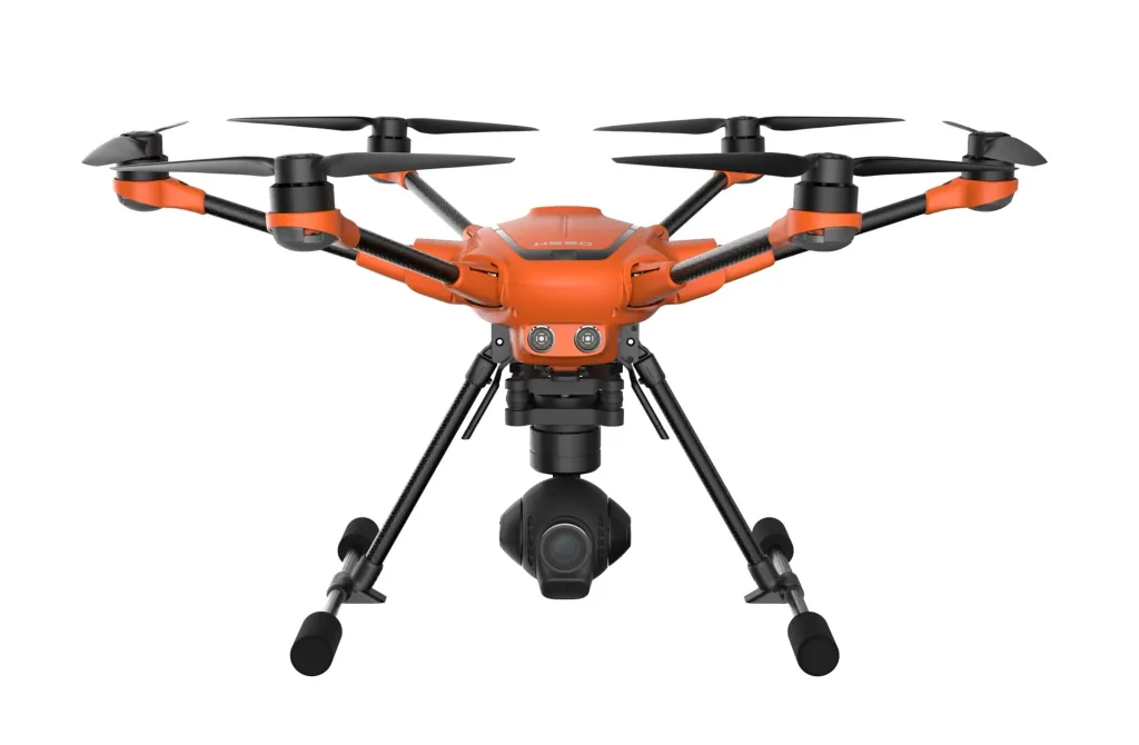
- 6 rotors for high safety and redundancy, as well as high stability and precision even in wind and turbulence
- Take-off weight with all available camera systems (E90/E50/CGOET) under 2 kg
- Reliable positioning through evaluation of GPS, Glonass, and Galileo satellites
- High-precision, low-interference compass
- Good visibility thanks to bright orange paint
- Video downlink encryption according to WPA2 standard with password
- No data transfer to third-party servers
- Software based on solid PX4 code
- Intelligent sonar collision avoidance for safe and stress-free flying
- Energy-efficient and quiet with up to 28 minutes of flight time (with E50) / 25 minutes (with CGOET/E90)
- Numerous, including customized, service and maintenance packages available
- ST16S with integrated 7" touch display, voice output, and comprehensive multilingual DataPilot™ software
- HDMI signal directly from the ST16S for outputting the drone's live image to larger monitors
The H520 was developed for inspection, law enforcement, security, construction, surveying, and mapping applications with the highest demands on flight time, safety, and flexibility, and carries camera systems that are also ideal for professional photography, cinematography, and television broadcasts. Its robust construction with a low-interference precision compass, the stable and extremely precise flight of the H520, and the comprehensive safety concept also make it the copter for demanding professionals and users who also seek the best in their private lives.
For industrial applications and demanding professionals
The 6-rotor system enables precise flight even in wind and turbulence and ensures that the H520 continues to fly safely even if one of the rotors should fail. The powerful U-Blox processor determines the H520's precise position using the GPS, Glonass, and Galileo satellite systems. The extremely energy-efficient motor management, together with the rotors, ensures unusually quiet operation and, depending on the payload, can achieve up to 28 minutes of operation from a single HV battery.
Variable and reliable
To monitor events or accident scenes from the air over an extended period, there is the option of permanently supplying the H520 with a wired power supply (tethering, available separately). To provide many participants with the same image information, the ST16S can be easily connected to larger output devices via HDMI. This allows, for example, the setup of local mobile command centers or the use of the live signal for TV productions. Three hot-swappable and gimbal-stabilized camera options are currently available.
With all cameras under 2 kg (cameras sold separately)
Thanks to the various camera options, the H520 can be easily adapted to a variety of applications. The E90 with a 1" image sensor and 20 MP resolution is perfect for applications that demand the highest photo and video quality. The E50 inspection camera, with its comparatively long focal length, allows for safe distance maintenance between the drone and the inspection object and, thanks to its close-up capability, will also impress film crews. And the well-known CGOET dual camera with thermal imaging and low-light sensors is ideal for firefighting and search and rescue operations. In all three variants, the H520 has a take-off weight of under 2 kg.
Everything in view
The usual foldable landing gear enables uninterrupted 360° video recordings and thus an unrestricted panoramic view from a bird's eye view - even in tethered mode. Comprehensive service packages are available optionally.
YUNEEC UpdaterPilot
Stay up-to-date with the YUNEEC UpdaterPilot for the H520 with E90 camera. The app, available in the Google Play Store, allows you to check and automatically update your copter to the latest software version. After opening the app and selecting WiFi and the camera, you can search for software updates with just one click on the "Check App Version" button and the latest update will be automatically downloaded and installed, if necessary. Please note that the YUNEEC UpdaterPilot can only be installed on the ST16S and that a micro SD card must be inserted in the camera and the H520 must be switched on to perform the updates. The YUNEEC UpdaterPilot is currently only available for the H520 with E90 camera.
ST16S Remote Control
The new Android-based ST16S is equipped with a fast Intel quad-core processor, providing sufficient performance reserves for computing-intensive flight apps. The integrated 7" touchscreen display ensures precise, intuitive operation of the H520 and displays all flight information as well as the live camera image in 720p HD. The standard DataPilot™ app is a complete software solution for conducting waypoint and survey missions and is fully integrated into the hardware and software of the YUNEEC H520. Just like the desktop application for Mac and PC, it allows missions to be planned, saved, and repeated or modified at any time. The user decides whether this is done on-site or in the office. The DataPilot™ can process and save maps from various providers, enabling flight even in areas without internet access.
YUNEEC DataPilot™
DataPilot™ enables the efficient and consistent creation of orthomaps, 3D scans, crop data images, and camera flights with repeatable flight paths without the need for additional, costly software. from third-party manufacturers. Surveillance flights, construction measurements, BIM components, perimeter security, accident reconstruction, forensic capture, 3D scanning, orthomosaics, and photo stitches are also created with the utmost precision and efficiency using the DataPilot™ interface. The DataPilot™ automatically generates a flight path to capture a defined area, including overlays and crossed trajectories for precision 3D or large-format images. Users can define the resolution by specifying either the flight altitude or the desired inches per pixel.
Software Development Kit (SDK)
The mobile SDK gives developers access to the H520's hardware and software. The SDK allows them to easily delve into the capabilities of the drone platform, as all more complex functions, such as flight stabilization, are abstracted. The SDK provides a simplified interface for interacting with the drone's components. It is suitable for implementing mission-specific functionalities. to implement and to teach the H520 completely new behaviors.
Data Transfer/Telemetry
- 720p live video feed via RTSP
- Real-time access to GPS, position, speed, altitude, status, battery capacity
- Footage download via WiFi
Flight Control
- Manual Mode: Control the H520 with the ST16S
- Mission Mode: Develop a mission on the mobile device, upload it to the H520, and execute the mission
Camera
- Capture videos and photos
- Select videos and photos
- Control camera functions such as aperture, shutter, ISO, and white balance
- Set image settings such as image size, format, and resolution
This is where the H520 comes into play Use
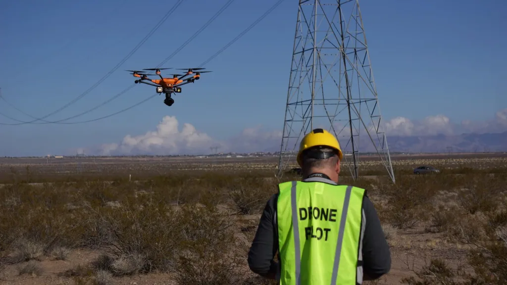
Whether for search and rescue operations, police and customs applications, firefighting, photovoltaic system inspections, film production, or inspection support – multicopters are increasingly being used in a wide range of applications. The use of drones is not only more cost-effective in numerous areas, but also more efficient, often offering a worthwhile alternative to conventional methods.
Inspections
Precise and clean drone images of every object to be inspected offer numerous advantages. The H520 hexacopter not only saves time, costs, and the personnel required for inspection, but also reduces the safety risks of a manned inspection. With the H520, you can capture all the necessary details without getting too close to the object. During the inspection flight, the drone's live image can be transmitted to a monitor, allowing several people to participate in the inspection and conduct initial analyses during the flight. Thanks to various camera options, the user always remains in the picture. flexible.
- Photovoltaic systems
- Wind turbines
- Buildings
- Other vertical structures
Search & Rescue
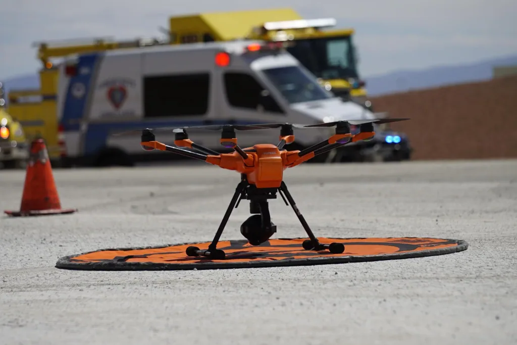
With multiple sensor compatibility, the H520 offers firefighters and rescue services reliable and efficient air support with the ability to change loads such as cameras in a matter of seconds. During searches for people, for example, rescuers benefit from the drone, which enables them to search areas from the air for missing people in the shortest possible time. In combination with a thermal imaging camera, the H520 can also detect fire hotspots during fires, enabling effective and rapid action against the fire, which in some cases can save lives.
- Fire department
- Rescue service
Security
The H520 can not only Not only can accident scenes be recorded quickly and easily in 2D and 3D, but dangerous situations can also be monitored from a safe distance and large events can be observed. Large areas can be searched within minutes. The H520 can also be of great assistance when assessing a crime scene, documenting the situation from above before entering the affected area. High-quality camera systems such as the E90 or the CGOET thermal imaging and low-light camera with embedded GPS data enable the area to be recorded prior to investigation by firefighters, accident investigators, or criminal investigators.
- Police
- Security
Photo & Film
Video productions often have to plan with lower budgets and great time pressure. The H520 enables producers to capture highly professional video footage and prepare repeatable camera movements, tilts, and settings using waypoint programming, and easily save and retrieve them for future recordings. Furthermore, not only can breathtaking landscape and panoramic photos be captured, but also in the field of portrait and wedding photography. Various camera options with hot-swap functionality provide the operator with powerful and flexible creative tools.
- Film production
- Wedding photography
- Landscape photography
Building Information Modeling (BIM)
Site surveys, topographical measurements, project progress, and even target-actual comparisons can be efficiently carried out using UAV technology. The YUNEEC H520 has been designed to conduct repeatable, optimally placed construction site overflights that not only record measurable and demonstrable project data, but also help identify take-off points, risk factors, and safety gaps. The ability to work with most well-known project management, BIM, and AutoCAD software makes a UAV a fast and safe tool for project managers and construction supervisors to track and measure.
- Construction planning
- Construction execution
Other areas of application
The H520 is also used in other areas, such as agriculture and forestry. The hexacopter can be a lifesaver when rescuing fawns. The pusher instinct, an innate protective behavior of fawns, which "press" themselves to the ground at just a few days old and do not move in order to remain undetected by predators, ensures that fawns do not move away from loud noises from combine harvesters. It is not uncommon for thousands of fawns to die each year as a result. Conventional protective measures are very time- and personnel-intensive. With a drone with a thermal imaging camera, fawns can be easily located and rescued due to their body temperature.
- Fawn rescue
- Agriculture and forestry
- Size: 520 x 455 x 295 mm
- Flight time: CGO-ET: 25 min. / E90: 25 min. / E50: 28 min.
- Weight: (with battery, without gimbal) 1633 g
- Battery: 4S 5250mAh 15.2V LiPo
- Charger: SC4000-4H
- Transmitter: ST16S
- Maximum flight altitude: 500 m
- Maximum rotation speed: 120°/s
- Maximum Rotation angle: 35°
- Maximum ascent speed: 4 m/s
- Maximum descent speed: 2.5 m/s
- Operating system: Android™
- Number of channels: 16
- Control signal range (optimal conditions): Up to 1.6 km
- Video link resolution: HD 720p
- Video link frequency band: 5.8 GHz WiFi
- Video transmission range (optimal conditions): FCC & CE standard: Up to 1.6 km
- Flight system telemetry data on display: Yes
- LCD screen: 7”
- Vibration and audio feedback: Yes
- Built-in LiPo battery: 3.6V 8700mAh 31.32Wh Li-ion
- Connectors: 1x HDMI, 2x USB, 1x earphone
Scope of delivery:
- Hexacopter H520
- ST16S remote control
- 2 batteries
- SC4000-4H charger
- Instruction manual
Extended service program
- Short runtimes and first-class service
- Regardless of your location, sending in the copter is free of charge.
- All repairs and maintenance work are carried out by professional service staff.
- If you have any questions, our service team is available weekdays from 9:00 a.m. to 4:00 p.m. You can contact us by phone, email, or via the ticket system. You are guaranteed a response within a maximum of 3 hours.
- Within the warranty period, all necessary warranty repairs are always carried out free of charge and within the specified business days.
- The term of the individual service packages is one Year.
- 3 service packages available
| Model building GPS support | |
|---|---|
| Model building GPS support | yes |
| Battery charger | |
| Battery charger | yes |
| Model building Number of rotors | |
| Model building Number of rotors | 6 |
| Model building Camera available | |
| Model building Camera available | no |
| Number of batteries | |
| Number of batteries | 2 |
| Technical features | |
| Technical features | Balancer |
| Technical features | Includes battery and charger |
| Technical features | Image transmission |
| Image transmission | |
| Image transmission | yes |